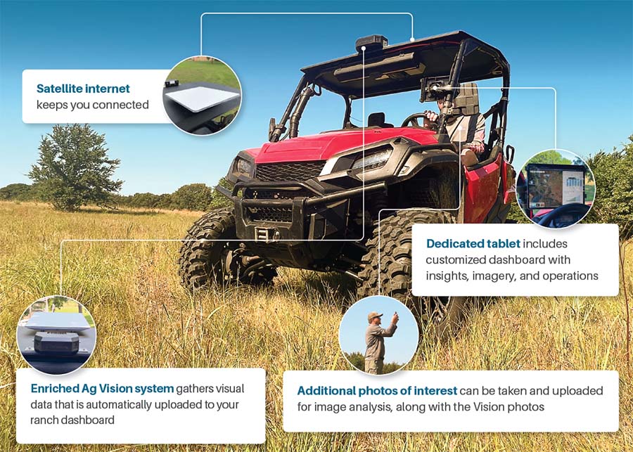
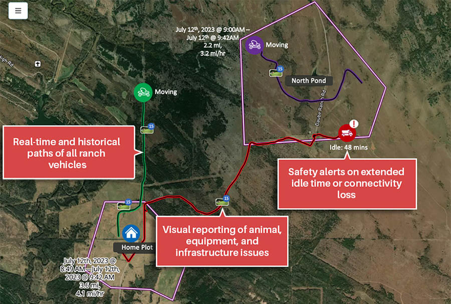
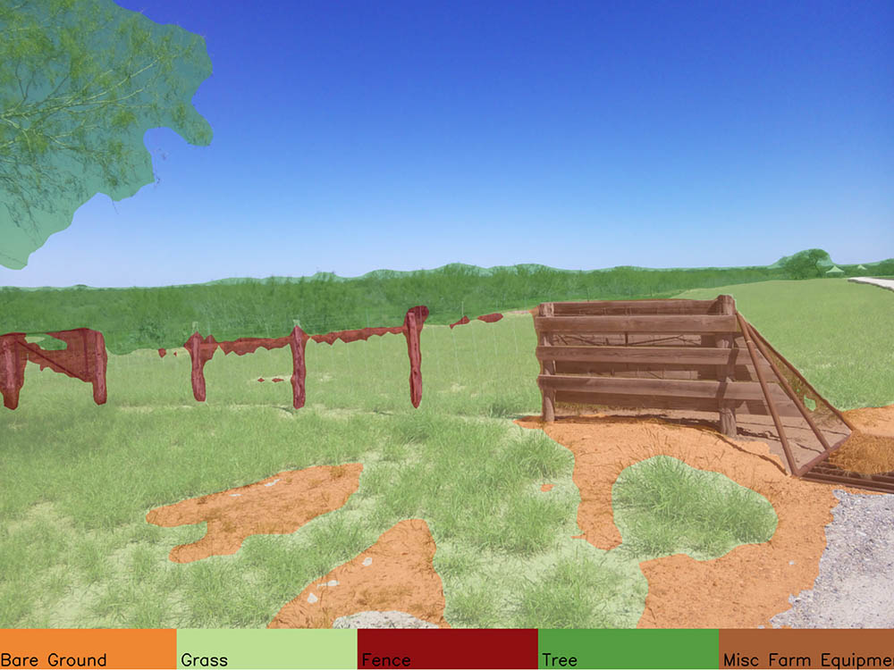
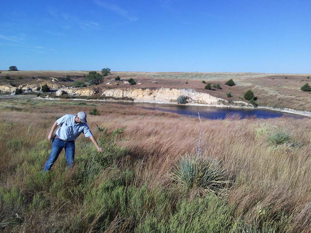
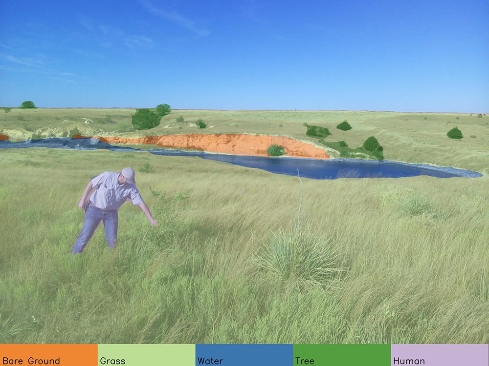
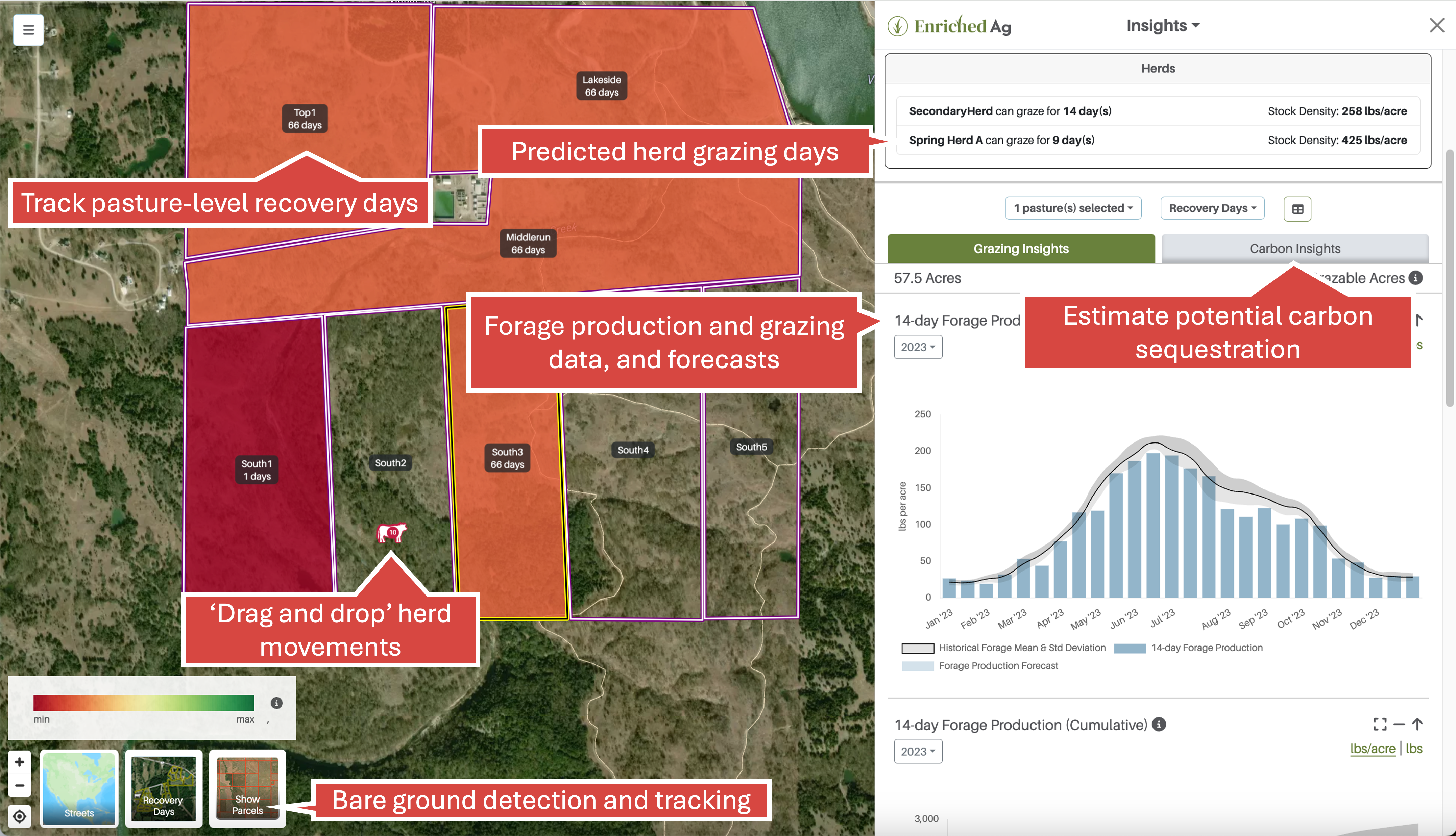
•  Ranch imagery is collected using our dual camera & any mobile device

  •  Satellite internet uploads photos automatically to Enriched Ag

  •  Enriched Ag’s machine learning engine creates a tagged, geo-referenced intelligent image library

  •  Images are available with insights & operational views in the field

  •  Ranchers make management decisions with data in the field

  •  Ranchers understand their land management over time

All of the features of other Enriched Ag products, in real time

RealTime Hardware

Real-Time Operations View

Using the operations view on your dashboard, see a variety of safety and weather alerts.

Operations View

Intelligent Image Library

The library includes visual, actionable observations about your land.

Infrastructure Image
Infrastructure Image Tagged
Water Image
Water Image Tagged
Cattle Image
Cattle Image Tagged

Enriched Ag Insights

View your grazing data, as well as carbon, rainfall, and water analytics. Click to learn more.

Enriched Ag Insights

Order Enriched Ag RealTime

Contact Sales
Call: +1 (406) 318-9631
Email: sales@enriched.ag

Enriched Ag Feature

Software for management

Dual Camera + Imagery Analysis + Insights

Satellite Connectivity + Vision + Insights

Forage production data (pasture specific)

Recovery and grazing days (pasture/herd specific)

Weather: temp, precipitation, and drought data

Identify and track biodiversity, bare ground, forage height, water sources, and aesthetic images

Photo Points: automatic collection of photos from the same location while driving

Drop a pin to a location of interest

Drive history records

Real-time image upload

Real-time operational overview of vehicles and collections

In-field image analysis and Insights visualization

The Enriched Ag Product Platform
Prev 1 of 1 Next
Prev 1 of 1 Next

The Enriched Ag Product Platform

Enriched Ag Insights

Enriched Ag Vision